Merging Building Information Modeling (BIM) and Geographic Information System (GIS) data provides a geo-spatial element that can be used especially for infrastructure design, allowing for more efficient workflows and consistent data.
This initiative came from the knowledge that the AEC industry has been facing a real challenge. How to solve the issue of lost data between stages of a construction project? In all different phases, from planning to operations, important information are lost on the way.
The evolution of the BIM industry created a real disruption in the construction industry. This evolution includes a digital transformation, moving from 2D to 3D building information modeling. The need of BIM and GIS integration brings a whole new approach to construction and planning.
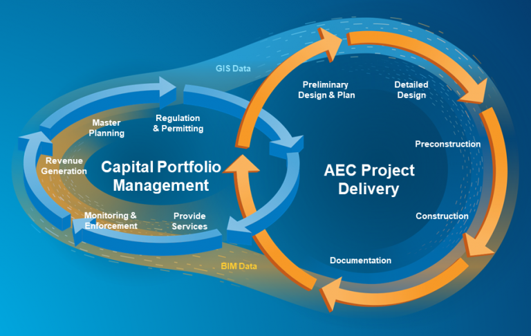
GIS data is necessary for planning all operations regarding infrastructures such as rail networks, airports, bridges, roads, and so on. It helps put this infrastructure in the context of its surroundings. While GIS helps understand how to put the infrastructure in that context, BIM information is the vital element that allows for the designing and building process of that infrastructure to take place.
BIM and GIS Integration and Benefits
- Moving data seamlessly between the stages of the design and construction process
- Adding effective geo-spatial context to the BIM process
- Better, improved designs and process
- Eliminating data redundancy
- Storing in the cloud to improve data management in any environment
- Reusing data if necessary
- Eliminating the need to convert data for use in other contexts